
Trip from Seattle to Salida Colorado to attend SW-FOG (Soutwest FJR Owners Group)
Index
Day 1 and 2 Renton to Ontario Oregon on NE Oregon backroads then Vernal Ut.
Day 3 - Explore Dinosaur National Monument
Day 4 - Ride roads in eastern Colorado end up in Gunnison.
Day 5 - Gunnison Co to Salida Co on the amazing Hwy 92
Day 6 - Loop ride from Salida to the spectacular Independence Pass
Day 7 - Salida Co to Boulder Co on some amazing backroads included Deckers.
Day 8 - Boulder Co to Kremmling Co enjoying some great canyon roads.
Day 9 - Kremmling Co loop to Rocky Mt. National Park, Berthoud and Loveland Passes.
Day 10 - Kremmling Co to Thermopolis Wy.
Day 11 - Thermopolis Wy to Home - Beartooth Pass a 1000 mile day - both first for me.
Day 1 and 2
My son graduated from the University of Washington with a BS in Economics on Saturday June 15th. We had a great time watching 4,500+ walk up and get their diplomas. Better yet was the family dinner afterward. The reason for mentioning this is, I am very proud of my son and I did not get to bed until 11:00pm on Saturday. To make matters worse I did not sleep well and got up at 5:30 with an ambitious first day ride plan - which I foolishly refused to change.
The plan was to enjoy minimize freeway travel on day one, travelling 600 miles then on day two ride from Ontario Oregon to Vernal Utah, nearly a 600 mile day. I was certain the first day would be splendid while the second day a slog down the freeway.
I could not have been more wrong.
Here is the route for day one. The route includes some of my favorite road in NE Oregon.
The bike was ready with a fresh rear tire, engine and final drive oil changed and a good wash jog. So I go out to start the bike, the engine turns but no ignition. I finally open the throttle while pressing the starter and it fires and runs fine. I shut it off and it fires right back up. This is a bad omen.
So I am off to Enumclaw where I take this photo of Mt. Rainier.

It was in the low 50’s when I rolled through Greenwater, Washington on my way to Chinook Pass.
Near Chinook Pass I take this photo.

The prior weekend it looked like this:

At Chinook Pass, June 15, I take this photo of Mt. Rainier and Tipsoo Lake.

On June 1st I took this photo at the same spot.

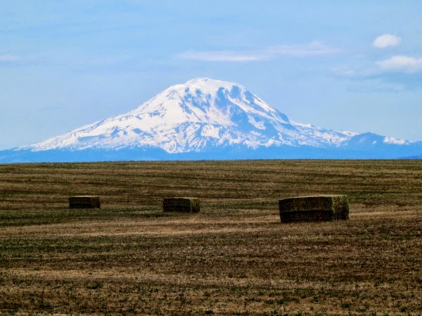
Continuing down Hwy 410 I got through Yakima and south on Hwy 97 where I found a couple of volcano’s to photograph.
Mt. Hood aka Snaggle Tooth

Mt. Adams aka an under appreciated mountain
Once reaching Oregon I head west on I-84 for 18 mile to the Dalles then take Hwy 197 south. This detour add 35 minutes to my ride but I enjoy the roads.
To my right Mt. Hood is my companion.

One of the reason to take this detour is to stop a White River Falls State Park.

And the other is to enjoy Hwy 216 a nice twisty road.

Then it is one to Hwy 218 on of Oregon’s finest.
Hwy 218 near Antelope Oregon

After this I got tired and it was clear on this day I extended myself too far. I continued on and finally made it to Ontario Oregon twelve hours after starting out, plus I crossed into Mountain time.
Day two is from Ontario Oregon to Vernal Utah via the slab. I was off by 8:00am with 68 degree temps with blue skies. The freeway pavement was surprising smooth, winds light and traffic no problem. The speed limit in Idaho is 75 on the freeway so I make good time. I really enjoyed the slab, easy no brainer, no loose gravel to think about or much of anything. Finally the mind was free and I was enjoying this trip.
Once reaching Odgen I went along I-84 to Morgan Utah. Along the road I notice many dead deer - good once less deer that can take me out.
I drove by Park City and Dear Valley looking at the ski hills I skied in the 1980’s.
At Strawberry Reservoir I shot this photo.

Nearing the end of day two, I had road from the Columbia River Basin, though the Salt Lake area which is a basin - water does not leave there, to the Colorado River Basin.
So after two long riding days I am a stones throw from Colorado. Now it is time to slow down and get into vacation mode. The day dawned with promise and a quick shower. Standing in the small bathroom I notice the toilet seat was open. I closed it because of the high probability I would knock something I needed into the toilet. Sure enough I did but it shaving cream bounce harmlessly off the seat and onto the floor. A good oman!
Out of the hotel at 7:30 and the McDonald’s breakfast stop by 8:15 I headed to Dinosaur National Monument because I was here and I like geology. My route ended up in Grand Junction a short 250 mile ride filled fun.
My first stop was the Quarry Exhibit Hall where 700 tons of bones were excavated and sent to the Carnegie Museum in Pittsburgh.
On the way to the quarry.

Out of the hotel at 7:30 and the McDonald’s breakfast stop by 8:15 I headed to Dinosaur National Monument because I was here and I like geology. My route ended up in Grand Junction a short 250 mile ride filled fun.
On the way to the quarry.
View at the quarry.

The quarry is build into the side of a hill as shown in the follow photos. It sits on the site of the original quary sight from the 1900's.

In the exhibit the quarry wall faces the visitors.


A femur from a Camarasaurus - yes it is the name of a dinosaurs.

The first structure built in 1958 was constructed on soft soil and had to be closed in 2006.

An Allosaurus.


It is very rare to find an entire skull.

The Green River from the Quarry Exhibit Hall.

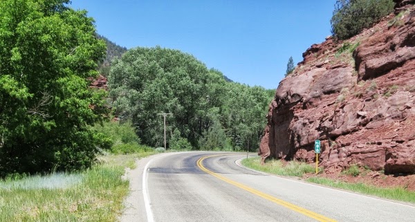
Hwy 149 just south of the Dinosaur National Monument


Next I go to Harper’s Corner Road to see the Green and Yampa River Canyons.
Do you like the wide angle view.

or the close up view.

The Echo Park road is a 13 mile each way down and back. It goes the confluence of the Green and Yampa rivers. You can also see Steamboat Rock.

Echo Park Road - Calling Auburn FJR do ride this on his FJR.

Steamboat Rock


Harper’s Overlook

Island Park Overlook

My FJR

Another Canyon Overlook

I started to look closer to find photography subjects.


Harper’s Corner Road was twisty is a few spots, but it was a chip sealed surface with some loose stone and quite a few straight sections. It was a smooth surface though.

And it was scenic.


Exploring Monument took about 3 or 4 hours. My only regret was not going for a day long river raft excursion.
About six month ago I bought Steve Fawson’s book titled The Complete Guide to Motorcycling Colorado: The Definitive Reference for ALL the Best Roads, Rides, and Tips. He rides a BMW 1200 GS and it cover dirt road too but does cover all the paved road I was interested in. In this book I found Hwy 139 leading me to Grand Junction where I will spend the night.
From Rangely Co Hwy 139 lead south and from the beginning it is rough or as Fawson says choppy. Doing the speed limit is not enjoyable. It is scenic and interesting especially as you approach 8200 Douglas Pass.
Looking south of Douglas Pass


The road has no lines is narrow, steep and interesting.


It is scenic though....

About 20 mile before I-70 Hwy 139 smooths out. I start seeing other things to photograph.

Different perspective of the flower.....


/rant
Bad internet connection at the Western Hotel in Gunnison Co. prevented me from posting last night. I was at the end unit and the signal strength was low. Grrrrr
/end rant
I decided to make this a riding day and see what I could see. After eating a quick breakfast, a banana, apple and coffee at the hotel I was on the road by 8:30. It was 75 degrees and the forecast is for continue hot, dry and windy weather. The humidity is real low - you can just feel it.
My route for the day takes me south on Hwy 141. This highway follow rivers bed. The landscape is sheer cliffs with flat plateaus.
Some examples.....


This one is called Thimble Rock.


After Gateway the road climbed out of the river bed for a while.

Starting in 1888 the Placerville Mining Company built a hanging flume. The flume used for gold mining carried about 24 million gallons of water a day. Unfortunately the sluice box was not designed to capture the flour gold found in the area. The project went bust in three years.
Rements of the flume


A wide angle view of the area. The flume 150 feet above the river bed.

I leave Hwy 141 taking Hwy 145 where arid scrub brush gives way to a pine trees and scenery a Pacific Northwest boy is used to.
Hwy 145

I am an ex-skier. I never skied Telluride so I decided to visit. I road there, got to town, did not stop and turned around and continue my ride. It was rather crowded up there. I was satisfied just to see the chair lift and say I was there.
Back down Hwy 145 I take a right at Hwy 62 which is rife with photo opportunities like this. One of these peaks is Dallas peak.


Hwy 62 meets with Hwy 550 where I head north. It it very windy out and begins to heat up with my decent. I arrive in Montrose where it is about 90 degrees and windy. Continuing north to Delta in search of more twisty road this day is not done yet!
I decide to take Hwy 92 - it is list in the Steve Farson’s book The Complete Guide to Motorcycling in Colorado. I gain elevation and the temp thankfully drops to about 72 degrees. The road is supposed to be a twisty affair running along the north rim of Black Canyon of the Gunnison. It does not disappoint although the low speed limits do.
There must have been a vintage Indian motorcycle event going on somewhere for I see a lot of old iron heading the opposite direction.
Hwy 92 photos:


I continue to Gunnison where I spend the night.
Day 5
My route for the day is dependent on crossing Colorado Hwy 12 most of which is gravel. The reports are it is very good gravel so I am not too worried about crossing. The reason for riding Hwy 12 is it is on of the most scenic road in Colorado with Aspens and magnificent views.
As I approach pavements end I see a sign saying Mag Chloride was being applied to the road. The road was closed for the next hour or so. I spoke with the lady holding the road closed sign. She said the solution was like a sticky salt brine used to keep the dust down. I was not willing to get a salt solution all over the bike so I turned around.
This meant a short trip to Salida over Monarch Pass.

The speed limit on US 50 near Monarch Pass

View from Monarch Pass

My route for the day is dependent on crossing Colorado Hwy 12 most of which is gravel. The reports are it is very good gravel so I am not too worried about crossing. The reason for riding Hwy 12 is it is on of the most scenic road in Colorado with Aspens and magnificent views.
As I approach pavements end I see a sign saying Mag Chloride was being applied to the road. The road was closed for the next hour or so. I spoke with the lady holding the road closed sign. She said the solution was like a sticky salt brine used to keep the dust down. I was not willing to get a salt solution all over the bike so I turned around.
This meant a short trip to Salida over Monarch Pass.
The speed limit on US 50 near Monarch Pass
View from Monarch Pass
Day 6
The group route for the day is over Independence Pass. Yes!
Rather than riding with the group I went into tourist riding mode, meaning I road this solo, so I could take pictures along the way.
Before the ride we had a group grope SW-FOG photo.

On the road..... wonderful.

Keep in mind I am doing all the photo with a Canon S100 pocket camera. Sweat.

A sheep is in the road. I was startled but had plenty of time to stop then take some photos.

Shooting into the sun is not good.

More road shots approaching Independence Pass riding from east to west.


At the Independence Pass overlook. My thoughs about Independence Pass can be summed up in one word - Massive!


Heading down the west side....


Aspen trees....


Day 7
The fire near South Fork spoiled my ride plans to Durango. I also I am tired of the 90+ temps, stiff wind and low humidity. In Colorado there many beautiful place in the Rockies but they are separated by vast expanse of hot, arid rangeland. Oh yeah internet access at the Gateway Hotel in Salida did work with a damn either - that also played a factor.
The new plan is to go to Mt. Evan the highest point you can drive to on a paved road in North America. So I created a route full of twisty fun. I highly recommend the book The Complete Guide to Motorcycling in Colorado by Steve Farson. Great book for finding the twisty road only the locals know about.
Along Hwy 25 near Fairplay.

Along the Tarryall Rd. Note this is under construction with a 10 mile gravel section. Not fun.
It was nice before it went to gravel.

My route took me to Deckers and up Pine Valley Roads. Great twisty and lot of LEO - good thing I was still in tourist mode.

It was Saturday and the road to Mt. Evans was crowded and slow going. It reminded me of the Going to the Sun Highway in Glacier National Park. The weather was cloudy and keeping the temps down - nice.
The top of Mt. Evans.


A screen shot of my GPS - it is accurate.

On the way down I shot a few photos.


I ended up in Boulder. Finding a hotel is not easy without a reservation. The lack of internet access in Salida made things difficult.
The group route for the day is over Independence Pass. Yes!
Rather than riding with the group I went into tourist riding mode, meaning I road this solo, so I could take pictures along the way.
Before the ride we had a group grope SW-FOG photo.
On the road..... wonderful.
Keep in mind I am doing all the photo with a Canon S100 pocket camera. Sweat.
A sheep is in the road. I was startled but had plenty of time to stop then take some photos.
Shooting into the sun is not good.
More road shots approaching Independence Pass riding from east to west.
At the Independence Pass overlook. My thoughs about Independence Pass can be summed up in one word - Massive!
Heading down the west side....
Aspen trees....
Day 7
The fire near South Fork spoiled my ride plans to Durango. I also I am tired of the 90+ temps, stiff wind and low humidity. In Colorado there many beautiful place in the Rockies but they are separated by vast expanse of hot, arid rangeland. Oh yeah internet access at the Gateway Hotel in Salida did work with a damn either - that also played a factor.
The new plan is to go to Mt. Evan the highest point you can drive to on a paved road in North America. So I created a route full of twisty fun. I highly recommend the book The Complete Guide to Motorcycling in Colorado by Steve Farson. Great book for finding the twisty road only the locals know about.
Along Hwy 25 near Fairplay.
Along the Tarryall Rd. Note this is under construction with a 10 mile gravel section. Not fun.
It was nice before it went to gravel.
My route took me to Deckers and up Pine Valley Roads. Great twisty and lot of LEO - good thing I was still in tourist mode.
It was Saturday and the road to Mt. Evans was crowded and slow going. It reminded me of the Going to the Sun Highway in Glacier National Park. The weather was cloudy and keeping the temps down - nice.
The top of Mt. Evans.
A screen shot of my GPS - it is accurate.
On the way down I shot a few photos.
I ended up in Boulder. Finding a hotel is not easy without a reservation. The lack of internet access in Salida made things difficult.
Day 8
Today the plan is to continue north zig zagging the canyon approach roads west of Boulder.
So again I created a route full of twisty fun.
Coal Creek Canyon where I spot three LEO just waiting for speeder. Thankfully I was still in full tourist mode.

After Coal Creek Canyon I descended Lefthand Canyon. There was a bicycle event and the cyclists were riding up the 16 mile long canyon. Quite an impressive feat.
I arrived in Lyon Colorado to find, my route, Hwy 7 running along the souteast side of Rocky Mountain National Park was under construction. The sign said alternate routes advised so heeded the advice and went to Este Park. I was going to check out Bear Lake Road in Rocky Mt. NP but it too was under construction and the crush of people in Estes Park convinced me to drop that section of this route.
So I was on to Buckhorn Road and finally found open highway once again and the usual low Colorado speed limits.
Buckhorn Road pics.


Nice pavement here.


I head west on Hwy 14 where a take a few more pictures. Great scenery along this section of Hwy 14 before Cameron Pass.


Today the plan is to continue north zig zagging the canyon approach roads west of Boulder.
So again I created a route full of twisty fun.
Coal Creek Canyon where I spot three LEO just waiting for speeder. Thankfully I was still in full tourist mode.
After Coal Creek Canyon I descended Lefthand Canyon. There was a bicycle event and the cyclists were riding up the 16 mile long canyon. Quite an impressive feat.
I arrived in Lyon Colorado to find, my route, Hwy 7 running along the souteast side of Rocky Mountain National Park was under construction. The sign said alternate routes advised so heeded the advice and went to Este Park. I was going to check out Bear Lake Road in Rocky Mt. NP but it too was under construction and the crush of people in Estes Park convinced me to drop that section of this route.
So I was on to Buckhorn Road and finally found open highway once again and the usual low Colorado speed limits.
Buckhorn Road pics.
Nice pavement here.
I head west on Hwy 14 where a take a few more pictures. Great scenery along this section of Hwy 14 before Cameron Pass.
I went south to spend the night in Kremmling Co.
Day 9
Today the plan is to visit Rocky Mountain National Park, Berthoud Pass and Loveland Pass.
Here is my route.
The first thing to catch my attention this morning it is it cooler in the Northern Colorado Rockies. I put my jacket liner. Nudge nudge hint hint Redfish Hunter.")
After getting underway the next thing to catch my eye is how small the Colorado River is near Kremmling Colorado.
Colorado River


I drive up the Trail Ridge Road to an elevation of 12215. It is odd at the summit there is no turn out or parking area so I go back a forth a time or two to capture a GPS screen shot.

Along the way I take a few pictures. It was cloudy on the way up.


Before the descent the clouds cleared. Nice.


On the way up I noticed the Colorado River trailhead parking lot. It was then I got the idea for this picture. So on the way down I stopped, found the river and took this picture of the Colorado River.

Next I went to Berthoud Pass. There was some construction. They were applying tar snakes. Construction cones made a mess of photo ops.

Berthoud Pass descent.

Next I went to Loveland Pass. I had to take I-70 and there was a 11 mile construction backup. Lucky for me I got on the freeway at about the 8 mile mark. The delay wasn’t too bad. The exit to Loveland Pass could not come soon enough.

From Loveland Pass

Loveland Pass descent.

I am spending the night in Kremmling Colorado.
Day 10
Today the plan is to visit Rocky Mountain National Park, Berthoud Pass and Loveland Pass.
Here is my route.
The first thing to catch my attention this morning it is it cooler in the Northern Colorado Rockies. I put my jacket liner. Nudge nudge hint hint Redfish Hunter.
After getting underway the next thing to catch my eye is how small the Colorado River is near Kremmling Colorado.
Colorado River
I drive up the Trail Ridge Road to an elevation of 12215. It is odd at the summit there is no turn out or parking area so I go back a forth a time or two to capture a GPS screen shot.
Along the way I take a few pictures. It was cloudy on the way up.
Before the descent the clouds cleared. Nice.
On the way up I noticed the Colorado River trailhead parking lot. It was then I got the idea for this picture. So on the way down I stopped, found the river and took this picture of the Colorado River.
Next I went to Berthoud Pass. There was some construction. They were applying tar snakes. Construction cones made a mess of photo ops.
Berthoud Pass descent.
Next I went to Loveland Pass. I had to take I-70 and there was a 11 mile construction backup. Lucky for me I got on the freeway at about the 8 mile mark. The delay wasn’t too bad. The exit to Loveland Pass could not come soon enough.
From Loveland Pass
Loveland Pass descent.
I am spending the night in Kremmling Colorado.
Day 10
Today the plan is to leave Colorado and spend the night in Thermopolis Wy.
Here is a route.
Before leaving Colorado for the flat lands in southern Wyoming I decide enjoy some of the twisty roads near Steamboat Springs.
Gore Pass is low elevation for Colorado standards.

Gore Pass

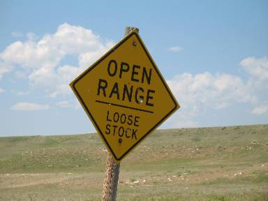
Range Land

Odd rock in the range land.

Same rock different perspective.

I blew by Steamboat Springs and up to Rabbit Ears Pass. I did not see any rabbit but did get some terrific view of the valley below. I took a few photos but nothing turned out - sometimes awesomeness can’t be caught with the camera.

I said goodbye the Aspen trees of Colorado and said hello to the flat land of southern Wyoming. But if you look hard enough there is always something to take a picture of. In this case the clouds are interesting.

The road rolls out of sight into the clouds.

I get a respite from the Wyoming range land along Hwy 20, the Wind River Canyon.

Wind River Canyon


I spend the night in Thermopolis Wyoming - a big mistake - the hotel was a dump. I tried to save a buck and it didn’t pay off. I should have went on up to Cody Wyoming. Worst was I had no internet. They said they had internet. I guess a wireless router sending an empty signal counts as internet service.... grrrrrr.
Day 11
Today the plan is to ride Beartooth Pass a first for me. After that I planned on going to Missoula Mt to spend the night. My how plans change and it is why I like riding solo. All the change would drive people nuts.
Here is a route.
I start off at 5:00am Mountain time and ride up to Cody Wy for a quick breakfast at a McD’s. Soon I am on Hwy 296, aka the Chief Joseph Hwy. This is a great road, a riders road where you can get out and enjoy the big sweepers, ride at a quick pace and enjoy the scenery! Awesome road.
Chief Joseph Hwy

There was a yellow caution sign before this photo saying “Caution road damage ahead”.
Never saw it. All I see is new gorgeous asphalt.

I also see a warning sign like this.
The fine black top continued for a few miles.

The typical Wyoming pavement replete with tar snakes returns but the scenery remain spectacular.

Chief Joseph Pass was too much fun. I reminded me of the North Cascades Hwy. A riders road not a gawker’s road. I take the left turn onto Hwy 212, Beartooth Pass.
Beartooth Pass Photos


The scenery is amazing. Like Independence Pass the word massive comes to mind.


After Beartooth Pass I head to I-90 and begin my trek to Missoula. Along the way I realize I can make it back home before sunset. This is my first 1000 mile day. The temperature was in the mid 60’s and low 70’s making for ideal riding conditions. So in one day I have three firsts, Beartooth Pass, Chief Joseph Hwy and a 1k day. I get home at sunset about 9:40pm Pacific time. It was an awesome trip.
The End


