
After a two month hiatus the FJR was calling. The goal was to see some of the burned areas from the fires in North Central Washington where thousand of acres burned, hundreds of homes were lost and three firefighters lost their lives. I wanted to see something different and ride roads never rode before.
Out of the house at 7:30 I am heading to Arlington where I can get off I-5 and the real ride begins. Here is my route for day one.
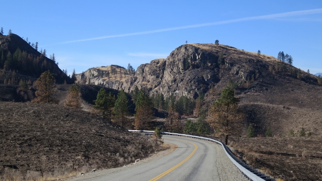
Ah the North Cascades Hwy. I ought to wire a mike to and talk about my thoughts as I ride this road again for the NNNth time since 1975 or so. I feel for you if you can’t ride this grand road on a whim.
Some falls colors with a power line. I have taken this photo before - it is a great fall shot less the darn powerline. This photo is a bit overexposed. Oh well.

The Methow River near Twisp


My route takes me on a few roads never rode before such as the B & O North Road and the Spring Coulee road. It was along here the fire damage was coming into view. In this photo the fire was stopped by apple orchards, with the fence posts on the right scorched by fire. Crazy.

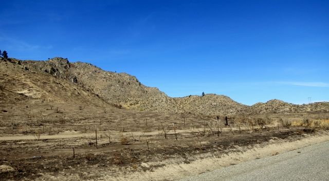

The area east of the city of Okanagan looks like the moon. Cattlemen who depend on the land are ruined. If their herd didn’t burn, they can’t feed what cattle they have left. The dilemma is cattle feed is too expensive and their land is burnt and will not produce grass for at least two seasons. Most are lucky to have their homes. Replacing a fence will cost $5000 per mile. Telephone poles have white X’s on them, meaning they need replacing. It looks like the moon.

What a tragedy.


A structure saved. There was many structures saved. Even from the motorcycle at highway speed I could see homes still standing but with damage from the extreme heat, such as buckled siding.


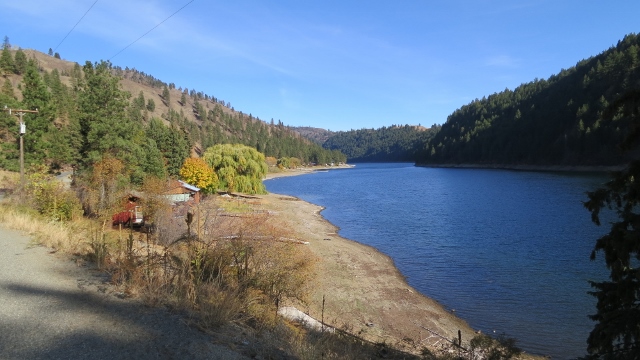
I am near Conconully when I took this picture. This is what the valley usually looks like.

At Conconully Lake.
This is where the road goes from pavement to gravel for 7 miles and area affected by fires resumes. The gravel road is named Sinlahekin Rd on Google maps, but it is a Forest Service road. The seven miles of gravel cuts a significant amount of time to get to Fish Lake Road. Instead of two down and outs I can ride a loop. I had no problem with the FJR on the gravel road.

End of Day One.
Day Two
I was planning on a three day ride but it did not work out that way. Oh well and that was fine. After seeing burned land mile after mile, a few more miles is sad but repetitive.
Here is my route for day two.
A photo of the Similkameen River near Nighthawk Washington where it was 39 degrees when I rolled through.

I thawed out on my way to Riverside Washington where I take the Tunk Creek Road. Good choice - this is a nice little down and back road one I have not been on before. Tunk Creek also was one of the five named major fires in North Central Washington in late September and the damage was along the road was dramatic.


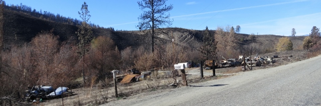
A few burned cars. I saw a burned garage with a burned car.
I returned home via Blewett Pass where I shot a few fall photos.


End of Trip.


