I started riding around the Mt. St. Helens area in 1968 on a Honda Trail 90. My parents would go Huckleberry picking around Mt St. Helens and Mt. Adams. We would lash the Honda to the bumper mounted rack on my Dad's pickup truck, drive to the Huckleberry field and I would get to ride the Forest Service roads in the area. For me it was the ultimate in summer recreation. I was all of 12 years old at the time.
Sometime in the late 1970's I road a CB450 Honda to the west side of Mt. St. Helens. I was near Harry Truman's cabin watching climbers head up the slope to have their fun. I picked up a piece of pumice about 2 inches in diameter and through it into Spirit Lake. To may amazement the rock floated. Wow man, look at that rock float I exclaimed, as we picked up more rocks and
absent mindedly tossed them into the lake.
Those are my earliest recollections of Mt. St. Helens. I didn't often visit Mt. St. Helens for Mt. Rainier aka The Mountain, a National Park, is a lot closer to Seattle and a lot bigger too. Washingtonian's treated Mt. St. Helens and Mt. Adams like some lousy unloved bastard child for we had The Mountain. Anyplace else in the USA
Mt. St. Helens and Mt. Adams would be National Parks. And so it goes.....
All that changed on 8:30am on May 30, 1980 when Mt. St. Helens exploded loosing 1300 feet of mountain in a matter of seconds. At the time I was sitting in my apartment, reading the newspaper and listening to the radio. Little did I know how good this was going to get!
Having a genuine killer volcano in your geological backyard brings in a lot of tourist. No longer is Mt. St. Helens treated like a spare change mountain.
In 1985 or so I was riding a 1983 Honda Silverwing a most miserable bike, while my buddy Rick was riding a 1976 or 1978 Goldwing. For some reason we decided to head down to Randle, Washington and ride south along the east side of Mt. St. Helens. Along Forest Service Road 99 at
Bear Meadow, near the edge of the blow down area, the road went from paved to unpaved. We continued anyway and reached the Windy Ridge visitor center. I will never forget the landscape. I was more like moonscape as everything was gray and the blow down area was nothing short of remarkable. Today vegetation is growing and it is quite different from 1985.
Today everybody flocks to St. Helens. Forest Service road (FS) 25 runs from Randle to just north of the Swift Reservoir. Here is a
map. Forest Service 99 is about 25 miles south of Randle and runs west to Windy Ridge. These are great motorcycle roads, less the first 25 miles south of Randle where you will be begging for a dual sport motorcycle with long travel suspension. These road are open from the middle of July through the first snows typically October. One year FS 99 was closed all year due washouts - this happens because the road bed is pumice. Bikers were jonesin' that year. Check out the
Forest Service web site before you go.
Last week I had new suspension installed on my FJR. New Penske shock and new springs and valves in the front end. What better way to try it out than along FS 25 on the way to Windy Ridge? The inspiration was set and my buddy Curtis joined me for this ride. We met at 6:00am in Enumclaw at Starbucks for coffee and a non-heart happy treat.
We leave Starbucks at 6:45 and this was our route to Windy Ridge.
View Larger Map
I did not get far before my first photo stop. All along I was thinking of my first ride to Windy Ridge with my buddy in 1985 and what do I see but this.....
 |
A 197x Goldwing just like my buddy's bike when we road to Mt. St. Helens in 1985.
Curtis is in the background on his Vstrom. |
Our route takes us over Cayuse Pass at 4500 foot pass in the Cascades where it was 48 degrees with snow still on the ground. It was overcast the pavement a bit damp. Meanwhile the rest of the nation is suffering from tipple digit heat. I regret not taking photos of the snow.
 |
| Approaching the tunnel along Hwy 123 |
We join Hwy 12 and head west to Randle the clouds with us the whole time. No rain though and I was happy to have the clouds as my companion for bright sunlight creates a high contrast lighting riding through the canopy trees on the ribbon of potholed asphalt that is FS25 outside of Randle.
The FJR's new suspension from
KFG Racing was performing flawlessly. It absorbed the potholes I missed and I was no longer begging for a long suspension travel dual sport machine. Yes!
The pavement is very good after leaving FS25 from FS99 to Windy Ridge, especially in westbound direction. Watch out for gravel in the blow down area though.
 |
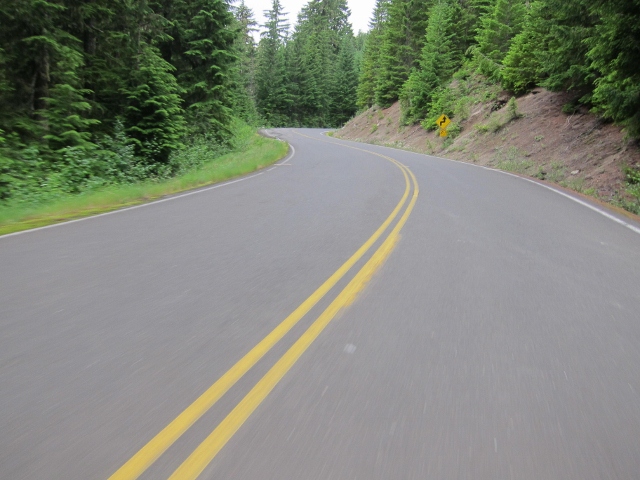
| FS99 on the way to Bear Meadow is some of the best twisties in the State. |
 |
| FS99 on the way to Bear Meadow
|
 |
| FS99 on the way to Bear Meadow - camera in one handle throttle in the other. |
 |
| FS99 on the way to Bear Meadow
|
 |
| FS99 on the way to Bear Meadow - the pavement is excellent. |
 |
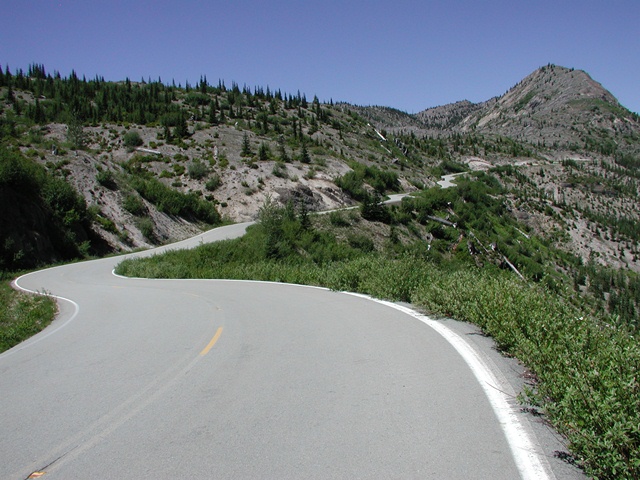
| FS99 on the way to Bear Meadow after this we enter the blow down area where the trees were blown down by the force of the eruption in May of 1980. |
 |
| See no old trees and this make for terrific site lines - come get it now before the new growth spoils the site lines. |
 |
| Near the Donneybrook pullout |
 |
| At the Donnybrook pullout you get a view of Spirit Lake |
 |
| Spirit Lake |
 |
| Spirit Lake |
 |
| On a clear day you can see Mt. Adams. It was not clear today so I pulled this one from my archives. Notice the car in the trees lower left side. |
 |
| This photo shot in 2006 is the background image on my GPS. Notice the excellent site lines and the sapplings along side of the road? Soon the site lines will be a thing of the past. Get it now while you can. |
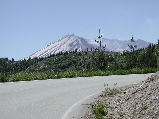 |
| Mt St. Helens along FS99 |
As I road along the road today my mind wandered. Why are they called Forest Service roads? Do the forests need servicing?
We left Windy Ridge viewpoint at about 10:00am or so. We beat the crowds! Yes. Here is the second leg of our route. Destination Woodland Wa for gas and lunch.
View Larger Map
We rejoin Hwy 99 and head south. Thankfully the road is in much better shape than the section south of Randle. The road is very twisty, except where it follows the Clearwater Ridge, going straight for a while then all of the sudden, wake up, for starts some extreme twisties again.
I learned this the hard way in 2001 and here is where I high sided my 1987 R100RT.
 |
| Where I crashed my in 2001 on my 1987 BMW R100RT |
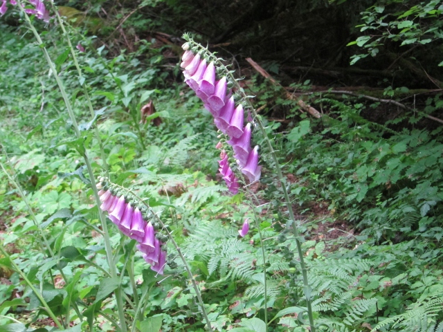 |
| Foxgloves along side the road make for a pretty site. |
 |
| Foxgloves along side the road make for a pretty site.
|
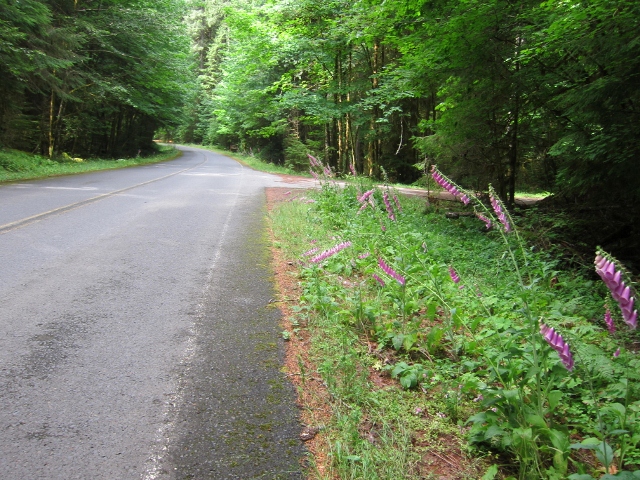 |
| Foxgloves along side the road make for a pretty site.
|
 |
| A canopy of trees along FS 25 near Cougar Washington |
FS 25 joins FS 90 at Swift Reservoir hugging two reservoirs along some excellent pavement all the way to Woodland. We stopped at the Lewis River Golf Course for a tasty lunch.
Along the way we get stuck behind some slow cars and I manage to throttle my assertive self and avoid passing the cars. Damn that is hard given the howling turbine nature of the FJR's engine.
We manage to avoid most of I-5 and here is the 3rd and final leg of our route.
View Larger Map
We go along Telegraph Road to Drew's Prairie Rd crossing under I-5 in an obscure manner. Continuing to Jackson Hwy, Tucker Rd and on to Hwy 508 to Elbe where the train was leaving
the station.
The End


