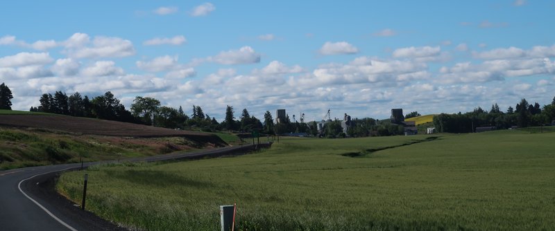
The past week has been foggy in usually soggy Seattle. Fog and moi do not get along well. I prefer rain for at least I can see the sky. Liquid sunshine is better than none at all.
So to get out of the fog I headed east. Fog socks in the Puget Sound lowlands so one only has to get above 1500 feet elevation to get out of the fog. The mountains and eastern Washington are clear. The trick is to leave at the right time so I don’t hit black ice in the mountain passes. Monitoring the WSDOT web site for statewide temps the day before is an excellent method to determine departure times.
So with a plan at hand (get out of the fog) and an 8:00am departure time designed to avoid black ice I will now shut up get on with the photo essay ride report.
Here is the route. I choose this route because Hwy 410 is the quickest way to get elevation to escape the eternal grey.
Near the Green River Bridge on Hwy 169 near Black Diamond.
Tractor along a back road near Enumclaw. The photo is a bit crooked will you forgive me?
The fog starts to lift near Mud Mt Dam as expected. Enjoy the show! I did.
Now out of the fog the next photo op is the million dollar shot of Mt. Rainier. This is better than summer shots due to the low angle of the sun.
Near Chinook Pass.
Tipsoo Lake at Chinook Pass before winter slumber. Chinook Pass is closed from mid November to Memorial Day. (typical)
Near Ohanapecosh Campground Hwy 123
Mt. Rainier near White Pass US Hwy 12 - nice eh?
After White Pass summit the fall colors started to kick in.
I finally pulled over to take a real photo figuring this colorful tree was worth a good shot. All photos on this trip were taken with a Canon Powershot S100. It is a pocket camera and I am enjoying the space it saves vs. my Canon Rebel.
Hwy 12 east of White Pass - the hills are on fall fire.
Dig this crazy scenery.
Going into the sun along Hwy 12 east of White Pass.
Near Oak Creek along Hwy 12.
My backyard!
After finding a non ethanol fuel dump in Yakima I headed up the Yakima River Canyon Road. I was in tourist mode all day so the stroll along the Yakima River was fitting.
Fishing in the Yakima River Canyon is a popular activity.
I pulled over for this shot!
After the Yakima River Canyon I enjoyed lunch at the Red Horse Diner in Ellensburg, went on to Thorp to see the historical Thorp Mill.
After visiting Thorp, a 3 minute affair because the Thorp Mill was closed, I set off on a route of seldom traveled county roads and I-90 to return home. At Snoqualmie Pass I stopped at Gold Creek Recreation site. It was 68 degrees at 3000 feet elevation.
About 3 miles from North Bend along I-90 I ran into fog again and in North Bend the temp was 47 degrees.
EOF
About Me
- Jim
- Hi and welcome to my motorcycle trip blog. Here you will find motorcycle trip reports primarily based in the State of Washington and Idaho. Born and raised in Washington I have over 50 years of motorcycle experience. Enjoy the ride.
Monday, October 21, 2013
Tuesday, October 8, 2013
North Cascade Hwy Fall Photo Essay
One of the pleasures of living in Washington State is riding the North Cascades Hwy on a whim. I rode it twice this year. Not as many as in past years but I have the pick of the choicest times. It is not on my list of roads rode too often.
This year we rode it in April and here is the route for last weekend. The difference is we rode it down and back in April and did a loop last weekend.
It was a very nice day for October in the Pacific Northwest. Temps on the ride to Monroe were in the low 40’s where I met Brian at McDonalds. After a cup of coffee, conversation and light breakfast we on our way east bound on the Stevens Pass Hwy.
Usually we avoid Steven’s Pass (aka US Hwy 2) because it is crowded on summer weekends and most other times too. Rarely do we ride it in the afternoon east to west - but west to east is not too bad most weekends. The norms held true and it was a nice ride to the summit of Stevens Pass. I was happy to have my electric jackets though.
A week earlier it was snowing in the Cascade Mountains and Crystal Mt, about 100 miles south, opened to 75 skiers for one day under very limited operation. Not to be outdone Steven Pass ski area opened their rail park for a one day event. As we zip across the summit I see much to my surprise cars in the parking lot with snowboards heading to the slopes. I thought this was odd for there was only six inches of snow at the base, not knowing until after the ride the ski area was actually open.
Here is a photo of Brian near the Stevens Pass summit.
Down the otherside I was trying to get some photos of fall colors. I got this instead.
It wasn’t long before we arrived in Wenatchee where we head northbound on Hwy 97 following the Columbia River.
Along the way we passed a group of people hiking along the road. While I was off shooting this photo, Brian
was talking with the hikers at the Wells Dam pullout. The group from England was hiking the Pacific Crest trail from Mexico to Canada but mountain snow derailed their plans so Hwy 97 was the new route to Canada. Determined bunch of Brits.
Brian wanted to take a photo of Wells Dam
It was about here Brian discovers the camera batteries are dead.
So I take the photo he wants.
And another photo at Wells Dam pullout - finally got the fall pic I was looking for. Riding 450+ miles and this is the fall image for the day. Sad indeed. Too much moto and not enough photo. This is the only patch of color in the area the rest is an off brown color like the 2013 FJR.
Columbia River along Hwy 97
We leave Hwy 97, saying goodbye to the Columbia River taking a left to Hwy 153, a scenic road that crosses the Methow River several times at it gradually gains elevation on the way to Twisp where we have lunch at the Twisp River Brewpub.
On the road again through Winthrop as western themed town toward Early Winters where I pull out the camera once again.
Brian on the road near Early Winters. Although the day started out with blue skies we travelled just for enough north to find a thin layer of high clouds, providing interesting light with the recent snow.
I decide to keep the camera in hand for a few miles creating a photo essay of the east side of the North Cascades Hwy.
Liberty Bell Mt. and a few clouds make for a nice shot.
The next one is my favorite. The tree on the left frames the photo well.
The Big Bend is near......
Brian in Big Bend below Liberty Bell Mt.
The Washington Pass Overlook is on top of the fault scarp in the lower right of this photo.
Washington Pass in 1/2 mile where the temps were surprisingly mild.
Continuing to Rainy Pass
Rainy Pass April 2013
Rainy Pass October 2013 - which do you prefer?
After Rainy Pass the road gets twistier.
Snowcapped mountains with your twisties?
We stop a the Cascadian Farm’s roadside stand for some great ice cream before heading home.
The End
Subscribe to:
Posts (Atom)
-
Day 1 I decided to go to Jellystone vs Jasper Alberta Canada today for the simple reason I don't want to ride in rain. Riding the I...
-
During the first full week on October my lovely bride and I flew to Boston toured Boston for two days then drove north to tour New Hampshir...
-
This is the last in a series of ride reports when the wife was away the King will play. The day before I rode around the Olympic Peninsul...
Yellowstone Ride Report
Day 1 I decided to go to Jellystone vs Jasper Alberta Canada today for the simple reason I don't want to ride in rain. Riding the I...