
It was Friday and the goal today was to ride more roads not rode often enough and ride a couple of roads never rode before. Riding roads not ridden is an accomplishment since I have lived around here all my days and have been riding for more than 40 years. The GPS got a good workout today.
Here is my route.
View Larger Map
Roads of not rode often today included BZ Corner to Glenwood Highway and the Glenwood to Goldendale road which follows the Klickitat Canyon. Both roads are terrific.
Roads never rode before include the Dee Highway, Copper Spur Road, Marmot Road, SE Ten Eyek Road and the SE Bull Run Road, all in Oregon, around Mt. Hood.
A fire at White Salmon, Washington along Hwy 141, part of my route, caused a late start. I made up an alternate route just in case but didn't need it.
With curiosity I was watching the smoke in the sky floating along the Columbia River generally moving to the southwest. Odd as the wind in the Gorge usually moves from west to east. The song Smoke on the Water by Deep Purple was on my mind. You may find the story of Smoke on the Water on Wikipedia more interesting than the song. Soon I was on Hwy 141 heading north to BZ Corner, the sky was thick with smoke the speed limit reduce to 35mph.
 |
| Smoke ahead. |
 |
| A little smoke with the twisties along Hwy 141 |
 |
| Mt. Adams along Hwy 141 |
 |
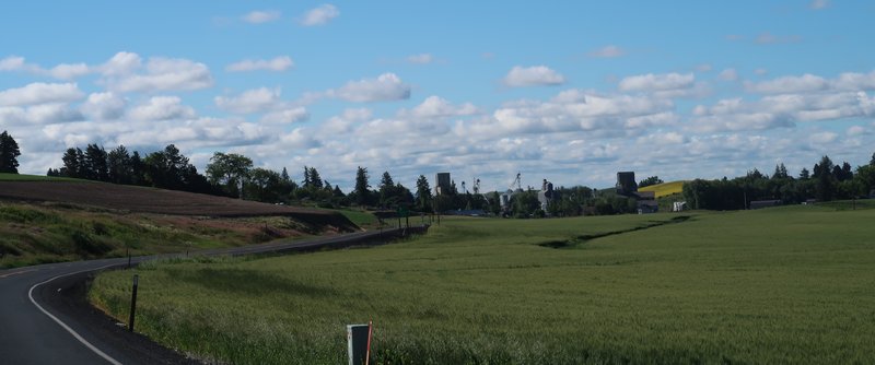
| Perhaps you prefer green pastures with your mountain photo? |
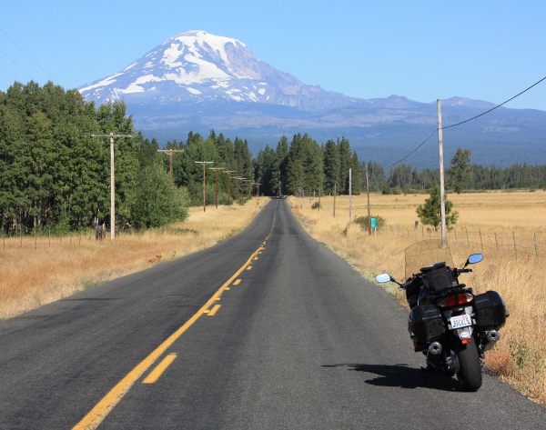 |
| Hwy 141 and Mt. Adams |
 |
| Glenwood to Goldendale Hwy |
My route joins with Washington State Highway 142 just south of Goldendale and heads south. Along the way I shoot these photos. Not bad for on the go.
 |
| Washington State Hwy 142 |
 |
| Washington State Hwy 142 |
 |
| Washington State Hwy 142 |
Winding down for a few miles the Hwy 142 soon follows the Klickitat River where fishermen in flat bottom boats create scenes from a Norman Rockwell gallery. At Lyle the Klickitat River ends and I am once again along the Columbia River. My route take me to Hood River on to the Historic Columbia River Hwy to the Rowena Loops. This is a great road! Often you see images on TV commercials or magazine adds with shots taken from the Historic Columbia River Highway. The scenery and geology here is amazing. During the last ice age the great Missoula floods scoured the Eastern Washington and the Gorge and created the fertile lands of the Willamette Valley.
 |
| Historic Columbia River Hwy on the way up to the Mayer State Park |
 |
| Historic Columbia River Hwy on the way up to the Mayer State Park |
 |
| Rowena Loops |
 |
| View from the Rowena Loops- I took this photo in August 2009. |
 |
| View from the Rowena Loops |
 |
| The Columbia River along the Historic Columbia River Hwy near Mosier, Oregon |
Next I ride on to Parkdale, Oregon following roads with great views of Mt. Hood. I tried to take some photos but facing the sun and Mt. Hood makes for crummy photographs. It is 1:30, about 85 degrees, hot by Northwest standards, and I am hungry so I stop at Apple Valley BBQ for a pulled pork sandwich. Yummie!
The ride continues along roads never rode. I can highly recommend the entire of length of the Cooper Spur road as it winds up toward Mt. Hood. The Cooper Spur road joins Hwy 35 where I run into a bit of construction while it is 90 degrees. Argh! Thankfully the wait was not long. Views of Mt. Hood are less than ideal. The southeast side is without snow or ice. It looks bare and unappealing. The camera stays in the bag.
The route joins Hwy 26 where I make good time around the south side of Mt. Hood with views of the ski hill at Timberline. All summer long Timberline is open for skiing and hosts the US Ski Team and ski camps for training. The training hill looks like a postage stamp of of snow on the hill. It is manicured every night and the ice/snow is usually hard as stone in the morning. I used to ski here a lot in the summer. It was a blast.
I head west on Hwy 26 turning at Brightwood to follow the back roads to Marmot Road, SE Ten Eyek Road and the SE Bull Run Road. All of these are interesting and heading west the view of Mt. Hood is behind me often obstructed by trees or ridges. I am tired a leave the camera in the bag. All of these are very nice road and provide a alternative to the busy and boring Hwy 26.
The plan is to re-join the scenic Columbia River Hwy and visit the Vista House at Crown Point, but a road sign says the route is closed the through traffic. I decide to call it a day and ride into Corbett, pickup the freeway and return to Stevenson Washington.
The End.


No comments:
Post a Comment